Andy Sacks/Getty Images
The Midwest—America’s Heartland—is celebrated for its agriculture, state fairs, and the friendly Midwestern spirit. Yet another defining feature of the region is its striking flatness. A 2014 study in the Geographical Review found that half of the ten flattest states in the U.S. lie in the Midwest, with Illinois, South Dakota, and Minnesota ranking second, third, and fifth respectively.
During the Quaternary period, which spans the last 2.6 million years, several ice ages covered large parts of North America with glaciers. Between 85,000 and 10,000 years ago, the Laurentide Ice Sheet stretched from the Northwest Passage to the Great Plains, sweeping across what is now the Midwest. As it advanced, the glacier ground down the underlying bedrock, smoothing the terrain into the broad plains we see today.
Glacial erosion was just one of the many ways ice reshaped the continent. The same forces carved the Great Lakes and redirected major rivers—Mississippi, Missouri, and Ohio—forming the waterways that would become vital arteries for American commerce. Without these glacial actions, the modern U.S. economy would look vastly different.
Beyond flattening the landscape, the Laurentide Ice Sheet enriched the soil that would become the nation’s breadbasket. As the ice moved, it pulverized rocks, sand, and clay, entrapping the debris within the ice. When the glacier retreated, it left behind a layer of glacial till averaging 100 feet thick. This sediment is mineral‑rich, free of large rocks, and exceptionally fertile—ideal for crop production.
Today the Midwest boasts more than 120 million acres of farmland that generates tens of billions of dollars annually. Approximately three‑quarters of this land is devoted to corn and soybeans, which together account for nearly half of the United States’ crop revenue. Without the flat, nutrient‑rich soils laid down by the Laurentide Ice Sheet, the country would be far less prosperous and far more food‑insecure.
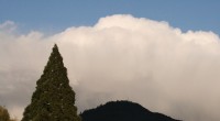
In the heart of the region lies the Driftless Area, a patch of land that escaped the scouring force of the Laurentide Ice Sheet. Located where Wisconsin, Illinois, Iowa, and Minnesota converge, the area remained untouched because the Northern Highland of Wisconsin redirected the glacier into the valleys that became the Great Lakes.
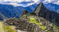
The Driftless Area stands in stark contrast to the surrounding flatlands, featuring steep valleys, limestone cliffs, and the highest point in the region—Blue Mound State Park at 1,719 feet. Its karst topography produces caves, sinkholes, and natural springs, providing unique habitats for plant and animal species that have survived since the glacial period. The rugged terrain also preserves some of the healthiest forest lands in the Midwest.