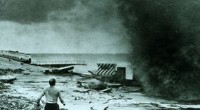
On March 18, 1925, a single tornado tore across the Midwest, becoming the deadliest storm in U.S. history. The Tri‑State Tornado traced an unprecedented 219‑mile (352 km) path through Missouri, Illinois and Indiana, striking over 200 communities and claiming 695 lives.
The tornado originated in south‑central Missouri within the warm sector of a powerful low‑pressure system. Cold, dry air advancing along a cold front collided with warm, moist air from the Gulf, creating the ideal environment for super‑cell thunderstorms. Meteorologists from the Storm Prediction Center (SPC) now recognize the triple point of the low’s track as a classic setup for a continuous tornado.
Because of limited meteorological records from 1925, it remains uncertain whether the damage was caused by one long‑lasting tornado or a family of tornadoes. What is clear is that the storm moved at an average of 59 mph (95 km/h), remained on the ground for over 3½ hours, and produced a path that remains unmatched in U.S. history.
The first touchdown occurred in Shannon County, Missouri, near the small town of Annapolis. The path then swept through Bollinger County, struck the Illinois towns of Gorham, Murphysboro, De Soto and West Frankfort, and finally crossed the Wabash River into Indiana. The tornado dissipated in Pike County after a three‑hour run.
In Murphysboro, the tornado demolished entire streets, including the historic First Baptist Church. Two schools—Logan School and De Soto School—were destroyed while students were inside. In Indiana, towns such as Griffin and Princeton suffered extensive property loss and casualties. The event remains a stark reminder of the fragility of rural communities in the face of extreme weather.
The combination of sheer intensity, high speed, and the absence of warning systems made the Tri‑State Tornado exceptionally deadly. In 1925 the U.S. Weather Bureau issued no tornado warnings, leaving communities unaware of the impending threat. The storm struck during school and work hours, amplifying casualties and complicating emergency response.
The tornado holds the U.S. record for the longest continuous path and the highest death toll for a single tornado. It cut through a variety of landscapes—mining towns, farmlands and densely populated areas—demonstrating the broad reach of such phenomena.
Modern meteorology owes much to the Tri‑State Tornado. The absence of radar, satellite imaging and emergency broadcasts in 1925 highlighted the need for systematic forecasting. Today, the National Weather Service employs tornado watches and warnings to provide real‑time alerts, significantly reducing loss of life. The NWS Paducah office and other regional centers continue to use the 1925 event as a key training case for forecasting and emergency response.
This article was created with AI assistance and subsequently fact‑checked and edited by a HowStuffWorks editor to ensure accuracy and credibility.