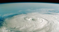
Clouds are more than fluffy shapes—they’re atmospheric weather indicators. By studying their form, height, and development, scientists can forecast everything from a sunny day to a looming storm.
Cirrus form high in the atmosphere, composed of ice crystals. Their hair‑like, wispy appearance often heralds an approaching warm front and can create halos around the sun or moon.
Image credit: Doug Armand / Getty Images
These classic “cotton‑ball” clouds signal fair weather. With a rounded top and uniform base, they can balloon vertically into more intense formations if atmospheric conditions allow.
Image credit: Roc Canals / Getty Images
Low‑lying, gray sheets that blanket the sky, stratus clouds bring steady light precipitation and can extend to fog when they touch the ground.
Image credit: Elizabeth Fernandez / Getty Images
Towering, vertically developed clouds that generate thunderstorms, heavy rain, and even tornadoes. Their dark, ominous tops can reach jet‑stream altitudes, warning of severe weather.
Image credit: Laura Hedien / Getty Images
Mid‑level, grayish‑blue sheets that spread across the sky. Often a precursor to frontal systems, they partially obscure the sun or moon while still allowing some light through.
Image credit: John Lawson / Getty Images
Rounded masses or parallel bands in the middle atmosphere, these honeycomb‑like clouds usually signal fair weather when seen in the morning.
Image credit: Supachai Panyaviwat / Getty Images
Thick, dark blankets that cover the entire sky, delivering continuous rain or snow. Unlike cumulonimbus, they lack vertical growth and spread laterally.
Image credit: shaunl / Getty Images
High, ice‑crystal clouds that form a thin veil over the sky. They often precede weather changes and can create halos, indicating rising atmospheric moisture.
Image credit: Richard Newstead / Getty Images
Small, white patches at high altitude with a rippled or honeycomb look. Generally associated with fair weather, though in tropical regions they may signal developing hurricanes.
Image credit: Adél Békefi / Getty Images
Low, bumpy clouds that cover the sky in rounded clusters. While they bring overcast conditions, they rarely produce heavy rain.
Image credit: Nancybelle Gonzaga Villarroya / Getty Images
Small, low clouds that drift lazily across the sky. Their limited vertical reach indicates stable, fair‑weather conditions.
Image credit: Elizabeth Fernandez / Getty Images
Taller than humilis, these vertical cumulus clouds hint at developing storms. They haven’t yet reached the intensity of cumulonimbus but are a warning sign.
Image credit: Rosa María Fernández Rz / Getty Images
A wedge‑shaped cloud that forms along a thunderstorm’s leading edge. Dark and ominous, it signals strong winds and rapidly changing conditions ahead of severe weather.
Image credit: Laura Hedien / Getty Images
A low, rotating cloud base that extends downward from a severe thunderstorm. Often dark and menacing, it can precede tornado development.
Image credit: Mike Hill / Getty Images
This article was produced with AI technology and subsequently fact‑checked and edited by a HowStuffWorks editor.