Visible satellite images use visible light, which is the same type of light that we can see with our own eyes. This type of imagery is good for showing details on the Earth's surface, such as land, water, and vegetation. However, visible satellite images can be difficult to interpret in areas that are covered in clouds or darkness.
Infrared satellite images use infrared light, which is a type of light that we cannot see with our own eyes. Infrared light is emitted by all objects, but the amount of infrared light that an object emits depends on its temperature. Hotter objects emit more infrared light than cooler objects. This type of imagery is good for showing the temperature of the Earth's surface, as well as for detecting objects that are hidden from view by clouds or darkness.
Here is a table that summarizes the key differences between infrared and visible satellite images:
| Feature | Visible satellite images | Infrared satellite images |
|---|---|---|
| Wavelength of light used | Visible light | Infrared light |
| What they show | Details on the Earth's surface | Temperature of the Earth's surface |
| Advantages | Good for showing details on the Earth's surface | Good for showing the temperature of the Earth's surface, as well as for detecting objects that are hidden from view by clouds or darkness |
| Disadvantages | Can be difficult to interpret in areas that are covered in clouds or darkness | Can be difficult to interpret in areas that are very hot or very cold |
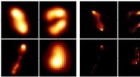
Here are some examples of infrared and visible satellite images:
[Image of the Earth taken with visible light](https://upload.wikimedia.org/wikipedia/commons/thumb/f/f4/Blue_Marble.jpg/1024px-Blue_Marble.jpg)
[Image of the Earth taken with infrared light](https://upload.wikimedia.org/wikipedia/commons/thumb/8/85/Earth_IR_2006.jpg/1024px-Earth_IR_2006.jpg)
As you can see, the visible satellite image shows more details on the Earth's surface, while the infrared satellite image shows more information about the temperature of the Earth's surface.