1. Elevation:
* Higher elevations are colder: As altitude increases, air pressure decreases, leading to a reduction in temperature. This is why mountains have colder climates than lowlands.
* Orographic precipitation: When air masses encounter mountains, they are forced to rise. As the air rises, it cools, leading to condensation and precipitation on the windward side of the mountain. This is known as the orographic effect.
* Rain shadow effect: The leeward side of the mountain, shielded from the prevailing winds, receives less rainfall, leading to a drier climate known as a rain shadow.
2. Topography:
* Valleys and canyons: Valleys tend to be warmer than surrounding areas due to the reduced wind speed and the accumulation of heat. Canyons can also experience unique microclimates due to their sheltered nature.
* Hills and plateaus: Hills and plateaus can create barriers to wind, leading to temperature differences between their slopes and surrounding areas.
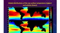
* Coastal areas: Coastal areas experience milder temperatures than inland regions due to the moderating effect of the ocean. Coastal landscapes are also influenced by ocean currents, which can transport warm or cold water.
3. Vegetation:
* Forests: Forests can have a cooling effect on the climate by absorbing sunlight and releasing moisture through transpiration. They also reduce wind speed and can influence precipitation patterns.
* Deserts: Deserts have a hot and dry climate due to the lack of vegetation cover. This allows for more direct sunlight and heat absorption by the ground.
4. Water bodies:
* Oceans and lakes: Large bodies of water moderate temperatures due to their high heat capacity. They also influence precipitation patterns, leading to higher humidity in coastal areas.
* Rivers and streams: Rivers and streams can transport heat and sediment, affecting local temperatures and soil composition.
5. Urban areas:
* Urban heat island effect: Cities are warmer than surrounding rural areas due to the absorption of heat by buildings and paved surfaces. This can create a "heat island" effect, leading to higher temperatures and increased air pollution.
Examples:
* The Himalayas: The Himalayan mountain range plays a significant role in creating the monsoon climate of South Asia, with the windward slopes receiving heavy rainfall while the leeward side remains drier.
* The Amazon rainforest: The vast Amazon rainforest contributes to the region's warm and humid climate by regulating rainfall and moderating temperatures.
* The Sahara Desert: The lack of vegetation cover in the Sahara Desert leads to its extreme hot and dry climate.
Overall, the interaction between landscape features and atmospheric processes creates a complex web of relationships that shapes regional climate patterns. Understanding these relationships is crucial for predicting future climate change and managing its impacts on different regions.