Remote sensing data can be used to create detailed land use maps, which can be used to segment the real estate market into different submarkets. This can be helpful for investors and developers who are looking to target specific types of properties. This technology can also help real estate professionals identify potential new markets and understand how different areas of a city are changing.
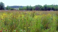
1. Mapping Land Use
Remote sensing can be used to create highly accurate and detailed maps that indicate how a piece of land is being used. These maps can be used for a variety of purposes, including identifying potential development sites or assessing the impact of a proposed development on the surrounding area.
2. Property Valuation
Remote sensing data can be used to estimate the value of a property by identifying factors such as the size of the lot, the type of structure on the property, and the proximity to other amenities. This information can then be used to create a model that can predict the value of a property.
3. Infrastructure Planning
Remote sensing data can help real estate developers identify potential locations for new development projects. This technology can be used to assess the availability of land, the proximity to infrastructure, and the potential impact of a development project on the surrounding environment.
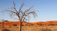
4. Disaster Risk Assessment
Remote sensing can be used to identify areas that are at high risk for natural disasters, such as floods, earthquakes, and wildfires. This information is critical for real estate investors and developers who are looking to minimize their risk.
Remote Sensing Data Sources:
1. Satellite Imagery: Satellite imagery is one of the most common sources of remote sensing data. Satellites collect images of the Earth's surface from space, and these images can be used to identify land use patterns, vegetation types, and other features.
2. Aerial Photography: Aerial photography is taken from airplanes or drones flying over the Earth's surface. Aerial photography can provide more detailed images than satellite imagery, but it is also more expensive.
3. Lidar: Lidar (Light Detection and Ranging) is a technology that uses lasers to measure the distance between a sensor and the Earth's surface. Lidar data can be used to create 3D maps of the Earth's surface, which can be used to identify land use patterns and other features.
Conclusion
Remote sensing is a powerful tool that can be used to transform the real estate industry. By providing accurate and up-to-date information about the Earth's surface, remote sensing can help real estate professionals make better decisions about where to invest, develop, and live.