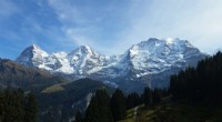
Rivers:
* Canyons: Deep, narrow valleys carved by river erosion over long periods. The Grand Canyon is a famous example.
* Gorges: Similar to canyons, but often narrower and steeper-sided, often formed by rivers cutting through resistant rock.
* Waterfalls: Formed when a river encounters a change in rock type, with a resistant rock layer overlying a softer layer. The resistant layer erodes more slowly, creating a drop in elevation.
* Meanders: Winding, looping bends in a river channel, formed as the river erodes the outer bank of a curve and deposits sediment on the inner bank.
* Oxbow Lakes: U-shaped lakes formed when a meander is cut off from the main river channel by erosion.
* Floodplains: Flat, low-lying areas adjacent to a river, formed by sediment deposited during floods.
* Terraces: Step-like landforms along a river valley, formed by the river eroding downward over time.
Coasts:
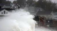
* Cliffs: Steep rock faces along the coastline, formed by the erosive action of waves and wind.
* Sea Caves: Cavities eroded into cliffs by waves, often containing air pockets that can create echoes.
* Sea Stacks: Isolated rock formations that stand out from the coastline, formed by wave erosion of a cliff.
* Archways: Natural openings in cliffs formed by wave erosion.
* Beaches: Areas of sand or shingle deposited by waves and currents.
* Sand Dunes: Ridges of sand deposited by wind, often found along coastlines.
* Headlands: Prominent stretches of high ground that jut out into the sea, often formed by resistant rock that erodes more slowly than surrounding areas.
* Bays: Indentations in the coastline, often formed by the erosion of less resistant rock.
It's important to remember that these features are often shaped by a combination of erosion and other geological processes, such as deposition, weathering, and tectonic activity.