Here's why:
* Physical features: Physical maps focus on showcasing the natural features of a region. This includes:
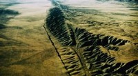
* Landforms: Mountains, valleys, plains, plateaus, deserts, etc.
* Water bodies: Oceans, seas, lakes, rivers, etc.
* Vegetation: Forests, grasslands, etc.
* Elevation: Physical maps often use contour lines or shading to indicate elevation differences, giving you a sense of the landscape's shape.
Other types of maps:
* Political maps: These show the boundaries of countries, states, and cities, focusing on human-created divisions.
* Thematic maps: These highlight specific themes, such as population density, climate, or resource distribution.
So, when you want to see the natural landscape of a place, a physical map is the one to look for!