* Before an earthquake: GPS stations can detect subtle shifts in the Earth's crust, indicating stress buildup in a fault zone. This helps scientists identify potentially hazardous areas.
* During an earthquake: GPS receivers record the rapid ground motion caused by the earthquake, providing valuable data on the earthquake's magnitude, location, and rupture characteristics.
* After an earthquake: GPS measurements help scientists understand the post-earthquake deformation, such as aftershocks and fault slip, contributing to post-earthquake hazard assessment and recovery efforts.
In summary, GPS systems help scientists:
* Track the movement of tectonic plates.
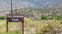
* Identify areas at risk of earthquakes.
* Monitor earthquake-related ground deformation.
* Understand the complex processes involved in earthquakes.
Therefore, a GPS in earthquakes is a valuable tool for monitoring and understanding these natural phenomena.