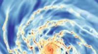
1. Resolution and Image Quality: Satellite images can have varying resolutions, which affect the level of detail they provide. Lower resolution images may not capture small-scale features or objects, leading to misinterpretation or oversight. Additionally, image quality can be impacted by atmospheric conditions, cloud cover, and sensor limitations.
2. Image Processing and Manipulation: Satellite images undergo various processing and enhancement techniques to improve their visual quality and extract information. However, this process can introduce distortions or alterations, potentially leading to misrepresentation or misinterpretation of the actual scene.
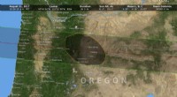
3. Temporal Changes and Updates: Satellite imagery provides a snapshot of the Earth's surface at a specific moment. It may not reflect current conditions due to rapid changes on the ground, such as urban development, deforestation, or natural disasters. Outdated or infrequent updates can hinder accurate analysis and decision-making.
4. Data Bias and Limitations: Satellite imagery can be biased toward certain types of information or features, depending on the sensors used and the purpose for which the images were captured. For instance, satellite images may prioritize infrastructure over natural landscapes, leading to a distorted representation of the environment.
5. Access and Control: Satellite imagery is not always freely available, and access may be restricted based on factors such as geographic location, data sensitivity, or commercial agreements. This can limit the ability of researchers, journalists, and the general public to verify or analyze satellite imagery independently.
6. Use in Misinformation and Fake News: Satellite images can be manipulated or taken out of context to support false narratives or spread misinformation. This can have serious consequences, especially when used for political or ideological purposes.
7. Privacy Concerns: High-resolution satellite imagery raises concerns about privacy and surveillance, as it can capture detailed information about individuals, private properties, and sensitive activities. Striking a balance between the benefits of satellite imagery and the right to privacy is essential.
To ensure responsible and accurate use of satellite imagery, it's crucial to critically evaluate the source, consider the resolution and limitations, verify the information with multiple sources, and be aware of potential biases or manipulation. Satellite imagery should be used as a tool to enhance understanding and decision-making, but not as an absolute truth without proper validation and context.