NASA's Aqua satellite provided a visible image of Tropical Storm Ida on Nov. 5 that showed a somewhat shapeless storm with limited organization.
Ida formed on Nov. 4 in the southwestern Caribbean Sea from the remains of Hurricane Julia. At the time, Ida was located several hundred miles south-southeast of Grand Cayman.
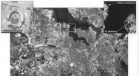
On Nov. 5 at 1:35 a.m. EST (0635 UTC), the Moderate Resolution Imaging Spectroradiometer or MODIS instrument that flies aboard NASA's Aqua satellite captured a visible light image of Ida over the southwestern Caribbean Sea. The MODIS image showed that Ida did not have well-defined bands of thunderstorms around the center, and its central convection was limited. The image also showed that Ida had an elongated appearance.
The National Hurricane Center (NHC) noted that "Shear from an upper-level trough north-northeast of the cyclone will increase through tonight, causing it to become less organized." Later in the day on Nov. 5, Ida is forecast to pass between Jamaica and Nicaragua, and then later turn to the northeast after it moves across eastern Nicaragua and Honduras.