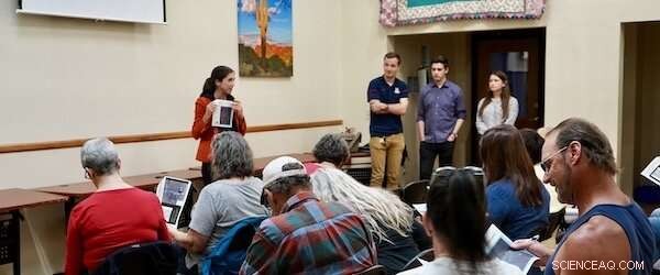
Courtney Crosson and UA architecture students facilitate a mapping activity to identify current flooding challenges at a neighborhood meeting. Credit: Portland State University
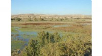
Short-term flooding from extreme storm events poses a serious transportation challenge in U.S. cities. This problem—which is anticipated to grow over the next century with our global climate crisis—is often hardest on vulnerable populations, including low-income and minority neighborhoods. The latest report from the National Institute for Transportation and Communities (NITC), led by Courtney Crosson of University of Arizona (UA), advances national research methods for assessing flood vulnerability and prioritizing transportation improvement investments to ensure that no community is left stranded when the next flood occurs.
Crosson and fellow researchers Daoqin Tong (Arizona State University) and Yinan Zhang (UA) conducted a flood vulnerability assessment of the City of Tucson, Arizona's multi-modal transportation system in low-income and minority neighborhoods. They identified priority locations for Tucson to invest in improvements to mitigate urban transportation system flooding, and are now working with city and regional agencies to implement those findings. This project also serves as a proof of concept to advance national research methods aimed at reducing the mobility impacts of chronic flooding.
Effective Use Of Green Infrastructure In Low-Income Neighborhoods
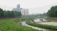
Green infrastructure is a growing urban trend where stormwater is managed by expanding permeable areas of natural vegetation throughout a city. This approach to water management is intended to protect, restore, or mimic the natural water cycle. Crosson's research team found that building comprehensive neighborhood-scale green infrastructure in the right-of-way is effective at increasing multi-modal access in moderate flooding conditions.
This green infrastructure solution did not address the mobility issues that result from extreme flooding. Rather than municipalities selecting areas that have the highest volumes of flooding or the highest volume of resident complaints, funds for green infrastructure should be invested in low-income neighborhoods subject to moderate flooding in order to achieve the greatest improvement of multimodal access.
Of the areas studied, 93% were part of census tracts with median household incomes below the Tucson average. Researchers intentionally focused on low-income neighborhoods, since too often people living in those areas are hardest hit by the impacts of natural disasters. Previous research in this area has focused heavily on the vulnerability of the transportation infrastructure alone, largely ignoring the people in the communities. A NITC project funded in 2020 will develop a new methodology that incorporates community socioeconomic vulnerability in the evaluation of transportation infrastructure vulnerabilities for cities and regions facing hazards.
Research Method For Assessing Flood Vulnerability In Transportation Infrastructure
Based on these model results, researchers identified five key green infrastructure design performance priorities.
Five Key Design Priorities For Green Infrastructure To Maximize Multimodal Accessibility
These five principles can be used by transportation planners and engineers, hydrologists, flood managers, and urban designers when approaching and evaluating project sites and investments to maximize the impact on increased multimodal accessibility.
Implications For Future Research And Practice
The research expects direct outcomes on future planning decisions made by the City of Tucson Department of Transportation, Tucson Water, Planning & Development Services, and Pima County Regional Flood Control District (RFCD). The NITC researchers on this project have met with the Director of Tucson Department of Transportation and RFCD, and the leadership of both agencies have expressed great interest in the research findings for upcoming decision-making around the allocation of green infrastructure funds for roadway flooding mitigation.
This research can serve as a proof of concept for a larger, long-term project to advance national research methods to reduce the impact of chronic flooding on the multi-modal transportation network. Future research should assess impact across time durations (rather than simple peak event calculations) and work to optimize green infrastructure implementation across multiple benefits for multiple modes of transportation (rather than individual modes).
By systematically prioritizing these projects in the right-of-way, cities can move toward increased transportation network accessibility and expanded equity.