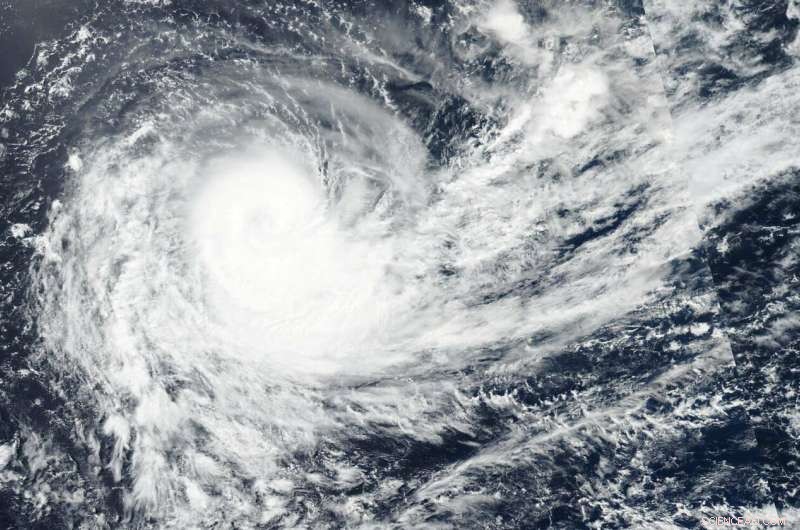
NASA-NOAA's Suomi NPP satellite passed over the Southern Indian Ocean and captured a visible image of Tropical Cyclone Haleh on March 6. Credit: NASA Worldview, Earth Observing System Data and Information System (EOSDIS).
Tropical Cyclone Haleh continued to move in a southerly direction in the Southern Indian Ocean when NASA-NOAA's Suomi NPP satellite passed overhead.
Suomi NPP passed over Haleh on March 6 and the Visible Infrared Imaging Radiometer Suite (VIIRS) instrument provided a visible image of the storm. The VIIRS image showed a large area of thunderstorms wrapping into the center and the storm appeared to be elongating toward the southeast. The elongation of the storm is a result of outside winds, or moderate to strong vertical wind shear, and is indicative of weakening.
On March 6 at 10 a.m. EDT (1500 UTC) Haleh was located at 23.9 degrees south and 68.7 degrees east. That's about 690 nautical miles east-southeast of Port Louis, Mauritius, has tracked southwestward. Maximum sustained winds had decreased to 75 knots (86 mph/139 kph).
Haleh is forecast to transition into an extra-tropical storm in two days and continue weakening.