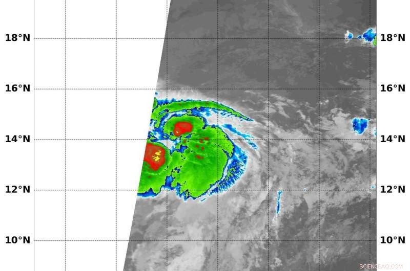
On Aug. 7 at 5:25 a.m. EDT (0925 UTC) NASA's Aqua satellite found coldest temperatures of strongest thunderstorms (red) in Tropical Storm Kristy were as cold as or colder than minus 70 degrees Fahrenheit (minus 56.6 degrees Celsius). Credit: NRL/NASA
Tropical Storm Kristy formed after John and Ileana in the Eastern Pacific Ocean today, Aug 7, but it is far to the west of John and Ileana and no threat to land areas.
Infrared data from NASA's Aqua satellite provided forecasters with temperature data that showed strong storms in the center of circulation.