Frankramspott/Getty Images
In the United States, tropical cyclones rank as the deadliest of the seven major climate and weather disasters. From 2013 to 2023, NOAA’s National Centers for Environmental Information recorded 3,712 fatalities linked to hurricanes and typhoons—regional names for the same type of storm.
All tropical cyclones—whether called hurricanes, typhoons, or simply cyclones—follow a predictable formation sequence. They can only develop when three core conditions converge:
The process starts with the ocean’s heat lifting moist air. As the warm, humid air rises, it cools and condenses into clouds, releasing latent heat. This heat buoyancy fuels further upward motion, drawing in additional moisture from the sea surface and generating the powerful winds that characterize the storm. The Coriolis effect steers the rotating flow, creating the familiar spiral structure: low‑level winds converge toward the center while upper‑level winds diverge outward.
Triff/Shutterstock
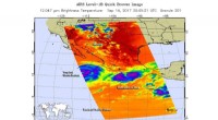
Understanding the internal layout of a cyclone is essential to appreciate its destructive power. The centerpiece is the eye—a 20‑to‑40‑mile‑wide clear, calm area where winds rarely exceed 15 mph. Although the exact physics remain a topic of research, the eye’s calmness is often attributed to centrifugal forces and angular momentum conservation.
Encircling the eye, the eyewall—located roughly 10‑20 miles from the center—is the most violent part of the storm. Here, towering convective clouds burst from the ocean surface, producing the heaviest rainfall and the strongest winds, which can reach up to 186 mph horizontally and 11‑22 mph vertically.
Beyond the eyewall, curved rainbands of thunderstorms extend outward. These bands deliver potent gusts, heavy downpours, and even tornadoes, while interspersed gaps often feel comparatively calm. Traversing from the eye to the outer rainbands, a storm’s intensity fluctuates between intense turbulence and brief periods of relative quiet.
Overall, tropical cyclones can span up to 620 miles in diameter, with most storms averaging between 124 and 310 miles across.
By grasping both the formation mechanics and the internal structure, scientists and forecasters can better predict storm evolution and protect communities at risk.