By B.T. Alo
Updated: March 4, 2025 2:21 am EST
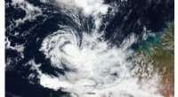
Yuliya Shavyra/Getty Images
Weather maps are indispensable tools that translate complex atmospheric data into visual stories, allowing forecasters, pilots, and the public to quickly grasp prevailing conditions. Each map type highlights specific variables—pressure, temperature, wind, and more—offering a nuanced view of the atmosphere.
Pressure maps display atmospheric pressure in millibars, pinpointing high‑pressure (anticyclonic) and low‑pressure (cyclonic) systems. High pressure typically indicates stable, clear skies, while low pressure often heralds cloudiness, precipitation, or storms. These systems form through the heating and cooling cycles of air masses, fluctuating on a daily basis. Learn more
Station‑model maps illustrate real‑time conditions at individual meteorological stations, using standardized symbols for temperature, humidity, pressure, cloud cover, and wind speed. Aggregating these stations produces comprehensive regional snapshots. Discover the symbols
Aviation maps are tailored for flight safety, presenting data such as wind vectors, dew points, icing zones, temporary flight restrictions, and front locations. Updated in real time, they empower pilots to navigate safely through complex weather environments. FAA aviation weather
Temperature maps showcase current temperatures either via color gradients or numerical labels. Often combined with cloud and precipitation overlays, they provide a quick visual cue for media outlets and weather apps. Explore temperature mapping
Streamline maps translate pressure gradients into wind flow patterns, offering clearer insight into actual wind behavior—especially valuable in tropical regions where pressure gradients are weak. These charts help meteorologists and sailors anticipate wind‑driven weather events. Bureau of Meteorology streamline charts