Here's a breakdown of how major ecosystems are identified and the tools involved:
1. Observation and Exploration:
* Field Observation: Ecologists spend time observing landscapes, studying plant and animal life, and analyzing the interactions between organisms and their environment. This often involves:
* Binoculars: To observe wildlife and bird behavior from a distance.
* Field Guides: To identify plants, animals, and other species encountered.
* Cameras: To document observations and capture images for later analysis.
* GPS: To track locations and map out areas of interest.
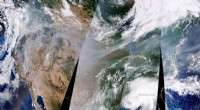
* Remote Sensing: This utilizes technology like satellites and aerial photography to capture data on large-scale patterns and changes in ecosystems.
* Satellite Imagery: Provides information on vegetation cover, land use, water bodies, and other features.
* Aerial Photography: Captures detailed images of landscapes and ecosystems.
2. Data Analysis and Classification:
* Data Analysis: Ecologists analyze collected data from field observations, remote sensing, and other sources.
* Classification Systems: They use established classification systems like the Biome classification system to categorize ecosystems based on their dominant plant life, climate, and other defining characteristics.
* Computer Modeling: This helps to understand complex relationships between organisms and their environment and to simulate ecosystem dynamics.
3. Defining Boundaries:
* Boundaries are not always sharp: Ecosystems often blend into one another, making it difficult to define precise boundaries.
* Ecological Criteria: Boundaries are established based on:
* Dominant species
* Climate patterns
* Soil characteristics
* Water availability
* Human impacts
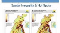
* Mapping: Maps are created to visualize the distribution and boundaries of ecosystems.
Important Note: "Major" ecosystems, such as biomes (e.g., forests, grasslands, deserts), have been recognized for centuries based on general observations and basic understandings of climate and vegetation. Modern tools and technology are increasingly used to refine our understanding of these ecosystems and to discover and study smaller, more localized ecosystems.
In summary, it's the combination of observation, data analysis, classification, and mapping that allows ecologists to understand and identify major ecosystems, rather than specific instruments alone. Instruments are valuable tools in the process, but they are not the sole determinant.