1. Hills and Mountains:
* Plateau: Large, elevated flat areas of land often forming the base of mountains.
* Mountain Ranges: Extensive chains of mountains created by tectonic activity, often with steep slopes and deep valleys.
* Volcanic Mountains: Formed by eruptions of magma, creating conical peaks and fertile soils.
2. Rivers and Water Bodies:
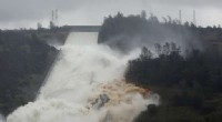
* Rivers: Extensive networks of flowing water, playing a vital role in shaping the landscape and transporting nutrients.
* Lakes: Large bodies of standing water, often formed by volcanic activity or tectonic shifts.
* Swamps and Marshes: Areas with waterlogged soils and dense vegetation, supporting unique ecosystems.
3. Other Landforms:
* Canyons: Deep gorges formed by erosion, often showcasing dramatic rock formations.
* Terraces: Flat areas of land created by deposition of sediment, often along riverbanks.
* Boulders and Rocks: Scattered throughout the rainforest floor, ranging from small pebbles to massive outcroppings.
* Sandbars: Temporary landforms formed by the deposition of sediment, often found along riverbeds.
Specific examples of landforms unique to rainforests:
* Butte: A hill with a flat top and steep sides, common in areas with high erosion rates.
* Mesa: A larger plateau with a flat top and steep sides, often found in arid regions but can also occur in rainforests.
* Sinkholes: Depressions in the ground formed by the dissolution of soluble rocks, common in regions with karst topography.
It's important to note that the specific landforms found in a rainforest will depend on its geographic location, geological history, and other factors.