Credit: contains modified Copernicus Sentinel data (2017), processed by ESA, CC BY-SA 3.0 IGO
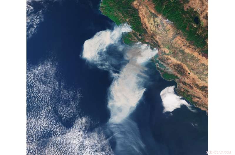
The Copernicus Sentinel-3A satellite captured this image of smoke from wildfires in the US state of California on 9 October 2017.
Wildfires broke out in parts of the state on 8 October 2017 around Napa Valley, and the smoke was spread by strong northeasterly winds.