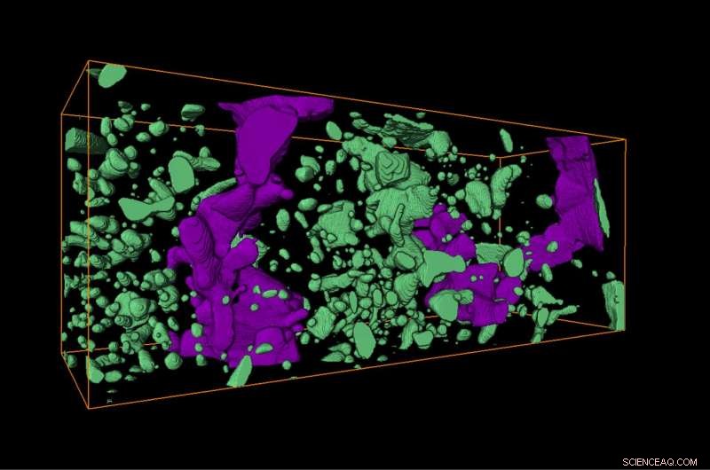
Focused ion beam image of small mineral inclusions that formed inside the fragmented garnet crystal due to fluid transport into pores in the garnet in the wake of the earthquake. The largest inclusions are about 20 micrometers long. Credit: Made by Oliver Plümper
(Phys.org)—A team of researchers from Norway, France and the Netherlands has found a new way to identify and measure seismic slips that occurred along fault lines during ancient earthquakes. In their paper published in the journal Science Advances, the team describes their study of garnet crystals found along a fault zone and what they discovered.
Because of erosion, there are very few ways to identify or measure an earthquake that occurred in the distant past. For that reason, geologists have been looking for better markers. In this new effort, the researchers report on one new marker in Norway that they believe could prove useful for identifying similar early earthquakes in other parts of the world.
To learn more about ancient earthquakes, the researchers were studying rocks along a fault line at Bergen Arcs in western Norway. There, they came across garnet formations that looked as if they had been melted and smeared as the edges of two continents slid past one another. They extracted some samples and took them back to their lab for analysis. Peeking at them through a microscope revealed microfractures so small that they did not change the shape of the rock.
A closer look showed that melted material had been injected into the fractures leaving behind a network of minerals, among them uranium. The team suggests the micro-fracturing occurred as a result of the earthquake. Next, because uranium decays to lead, the researchers measured the lead content in the material within the fractures, and calculated a date for when the earthquake occurred—approximately 420 million years ago. The researchers also found that they could use the garnet to measure the amount of slippage that occurred between layers of rock. Their calculations indicated the earthquake would have measured 6 to 6.5 on the Richter scale, which means it was relatively strong. They note that humans would not have been around to feel it, but animals at the time likely did.
The researchers suggest their method could be used as a marker for finding other ancient earthquake sites and to aid in measuring their slip rates, and thus earthquake magnitude as well.
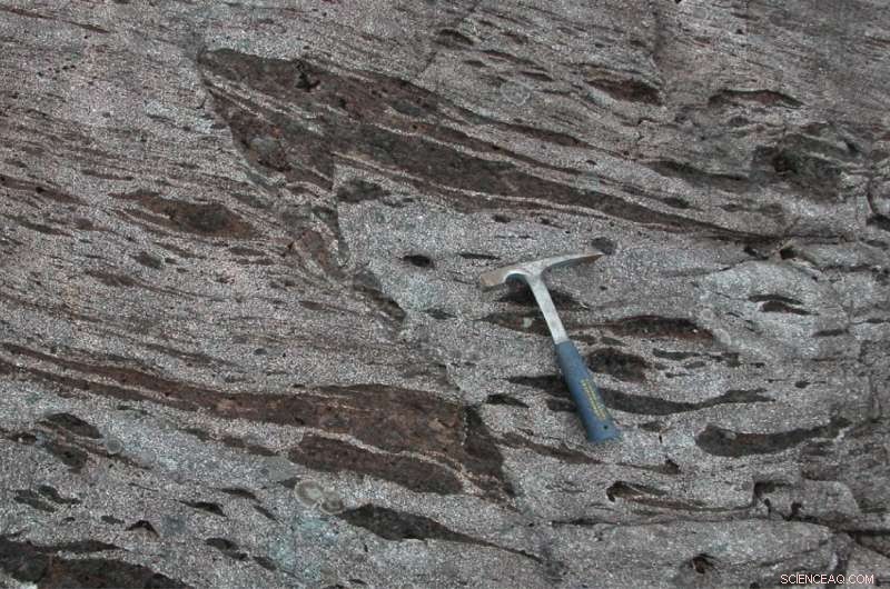
Field image showing the fault displacement (visible by the offset of the dark layer) associated with an earthquake of an estimated magnitude around 6. This earthquake occurred in Western Norway some 50 kilometers below the Earth’s surface about 420 million years ago. Credit: Bjørn Jamtveit
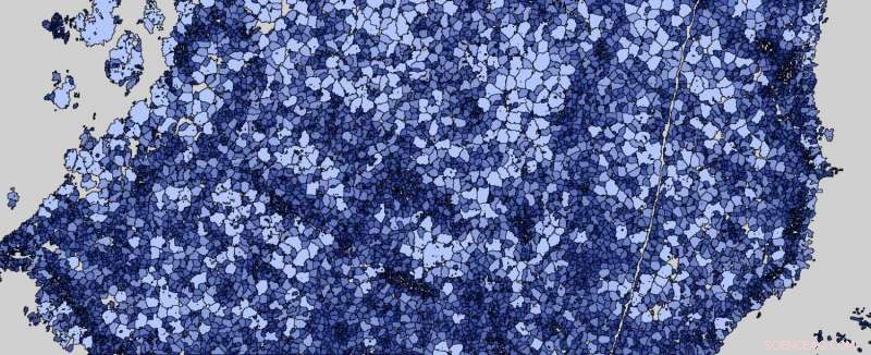
Completely fragmented garnet crystal (about 1 millimeter in diameter) located at the earthquake slip surface. The upper left part of the crystal was cut off by the earthquake. Credit: Kristina Dunkel
© 2017 Phys.org