Remote Sensing:
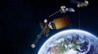
* Satellites: These orbit the Earth and collect data from a distance using various sensors. Some examples:
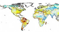
* Landsat: Provides images of Earth's surface, used for monitoring land cover, agriculture, and natural disasters.
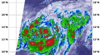
* GOES: Measures weather patterns and provides real-time data for forecasting.
* MODIS: Monitors the Earth's surface, including vegetation, oceans, and atmosphere.
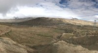
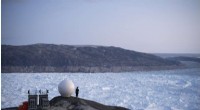
* Aircraft: Used for aerial photography, collecting data on land cover, and surveying natural features.
* Ground-based sensors: These include:
* Weather stations: Collect data on temperature, humidity, wind speed, and precipitation.
* Seismic stations: Monitor earthquakes and the Earth's interior.
* Radar: Used to map terrain, track weather, and detect movement.
Direct Observation:
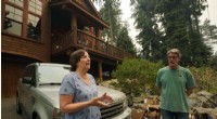
* Field research: Scientists go out into the field to collect samples, take measurements, and observe phenomena directly. This includes:
* Geologists: Study rocks, minerals, and landforms.
* Biologists: Study plants and animals in their natural habitats.
* Oceanographers: Study the oceans and marine life.
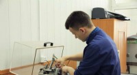
* Laboratory experiments: Scientists conduct controlled experiments in laboratories to study specific processes and phenomena.
Other Tools and Techniques:
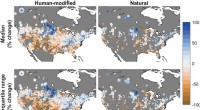
* Computer models: Scientists use computer simulations to model Earth processes and make predictions.
* Data analysis: They use statistical methods and computer programs to analyze data collected from observations and experiments.
The Specific Tools and Methods Used Depend On:
* The type of research being conducted: A geologist studying rock formations will use different tools than an oceanographer studying ocean currents.
* The location being studied: Different tools and techniques are used to observe different parts of the Earth.
* The scale of the study: Scientists studying the entire globe will use different tools than those studying a small area.
It's important to remember that scientists use a combination of these tools and methods to get a comprehensive understanding of the Earth.