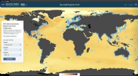
1. Biogeographic Realms:
* Concept: This method divides the Earth into large, distinct areas based on shared evolutionary history and patterns of plant and animal life.
* Examples: Nearctic (North America), Neotropical (Central and South America), Palearctic (Europe and Asia), Afrotropic (Africa), Indo-Malayan (Southeast Asia), Australasia (Australia and nearby islands), Oceanic (islands in the Pacific).
* Advantages: Useful for understanding large-scale patterns of biodiversity and evolutionary relationships.
* Disadvantages: Can be somewhat arbitrary and may not capture finer-scale variations in species distribution.
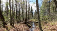
2. Biomes:
* Concept: This approach classifies Earth's surface based on climate, vegetation, and the types of organisms that inhabit a particular region.
* Examples: Tropical rainforest, temperate deciduous forest, grassland, desert, tundra, taiga.
* Advantages: Provides a framework for understanding the influence of environmental factors on life.
* Disadvantages: Can be oversimplified, as biomes are not always distinct and can have overlapping characteristics.
3. Ecoregions:
* Concept: This method combines both biogeographic and ecological considerations to define relatively small, homogeneous areas with distinct combinations of species, ecosystems, and environmental conditions.
* Examples: The Amazon rainforest, the Great Barrier Reef, the California chaparral.
* Advantages: More detailed and nuanced than biomes, better reflecting the specific characteristics of different areas.
* Disadvantages: Can be more difficult to define and map consistently.
4. Habitat Types:
* Concept: Focuses on the specific physical environment where organisms live.
* Examples: Forest, grassland, wetland, coral reef, cave.
* Advantages: Useful for understanding the specific adaptations of organisms to different environments.
* Disadvantages: Can be too narrow in scope, as different habitat types can overlap.
5. Geographic Coordinates:
* Concept: Scientists use latitude and longitude to pinpoint precise locations on Earth.
* Examples: A research study might focus on a specific forest in the Amazon rainforest at a particular latitude and longitude.
* Advantages: Allows for precise study areas and data analysis.
* Disadvantages: Doesn't necessarily account for broader ecological patterns.
6. Sampling Methods:
* Concept: Scientists use various sampling methods to select representative areas for study, such as:
* Random sampling: Choosing areas randomly to avoid bias.
* Stratified sampling: Dividing the study area into different strata (e.g., different habitat types) and selecting samples from each stratum.
* Systematic sampling: Choosing areas at regular intervals (e.g., every 10 kilometers).
* Advantages: Can provide a more accurate representation of the biodiversity within a given region.
* Disadvantages: May not capture all the variation in a region.
Ultimately, the best way to divide the Earth for studying living things depends on the specific research question being addressed. Scientists may combine multiple approaches to gain a comprehensive understanding of the distribution and ecology of organisms.