Here's why:
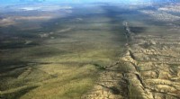
* Plate Tectonics: Geology studies the Earth's structure, composition, and processes. A major part of this is plate tectonics, which explains the movement of the Earth's crustal plates. This movement is responsible for the formation, separation, and shifting of continents over millions of years.
* Mapping and Data Collection: Geologists use a variety of methods to map and study continents, including:
* Satellite imagery: To analyze landforms and geological features.
* Geophysical surveys: To study the Earth's internal structure and the movement of tectonic plates.
* Fieldwork: To collect rock samples and study geological formations directly.
* Historical Analysis: Geology helps us understand how continents have evolved over time, from their formation through supercontinents like Pangaea to their current positions.
While other disciplines like geography and cartography focus on mapping and studying the Earth's surface, it is geology that provides the scientific foundation for understanding the formation, movement, and shapes of continents.