1. Geology and Geography:
* Landform mapping: Aerial views help understand the shape and structure of landscapes, including mountains, valleys, and coastlines.
* Remote sensing: Satellites and drones capture aerial images and data to analyze land use, vegetation, and geological features.
* Environmental monitoring: Tracking changes in land cover, deforestation, or natural disasters using aerial imagery.
2. Biology and Ecology:
* Animal behavior studies: Observing animal movements, migrations, or habitat use from above.
* Plant community mapping: Aerial photos can identify different plant species and their distribution in an area.
* Wildlife conservation: Monitoring animal populations and identifying potential threats.
3. Archaeology and Anthropology:
* Site surveys: Aerial photos reveal archaeological sites, such as ancient settlements, burial mounds, or agricultural patterns.
* Urban planning: Understanding city layout, infrastructure, and population density.
4. Meteorology and Climate Science:
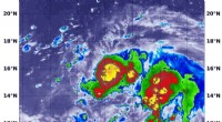
* Weather patterns: Observing cloud formations, storm systems, and atmospheric conditions.
* Climate change studies: Monitoring glacial retreat, sea level rise, and changes in vegetation cover.
5. Engineering and Architecture:
* Construction progress: Assessing the progress of large-scale projects like bridges or buildings.
* Infrastructure planning: Identifying optimal locations for roads, pipelines, or other infrastructure.
In summary:
An aerial view provides a unique perspective that allows scientists to study and understand the Earth's surface, biological systems, and human activities in a comprehensive way. It's a valuable tool for research, monitoring, and planning across diverse disciplines.