1. Latitude:
* Latitude refers to the distance from the equator.
* Low latitudes (near the equator) receive the most direct sunlight throughout the year, leading to consistently warm temperatures and a tropical climate. This zone typically experiences high rainfall and humidity.
* Mid latitudes (between the tropics and the poles) experience a greater variation in temperature between seasons, with temperate climates. These zones can have distinct summer and winter seasons, as well as varied precipitation patterns.
* High latitudes (near the poles) receive less direct sunlight and experience much colder temperatures year-round, resulting in polar climates. These zones often experience extreme cold, low precipitation, and long periods of darkness in winter.
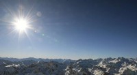
2. Altitude:
* Altitude is the height above sea level.
* As altitude increases, air becomes thinner and less dense, leading to a decrease in temperature. This explains why mountaintops are often colder than valleys.
* Higher altitudes can also experience changes in precipitation patterns. For instance, mountain ranges often act as barriers to moisture, resulting in rain shadow deserts on their leeward sides.
3. Proximity to Large Bodies of Water:
* Water has a higher heat capacity than land, meaning it takes more energy to change its temperature.
* Proximity to large bodies of water can moderate temperatures. Coastal areas tend to have milder winters and cooler summers compared to inland locations at the same latitude.
* Water also influences precipitation patterns. Coastal areas often receive more rainfall than inland areas due to the evaporation of water from the ocean.
In summary, the interaction of latitude, altitude, and proximity to large bodies of water determines the three main types of climate zones: tropical, temperate, and polar.
It's important to note that these are just the three main climate zones. There are many sub-types within each zone based on other factors like specific precipitation patterns, wind systems, and even human activities.