Land Cover:
* Forest cover: Mapping forest types, deforestation, and regrowth.
* Agriculture: Identifying crop types, monitoring crop health, and assessing irrigation needs.
* Urban areas: Tracking urban sprawl, land use changes, and infrastructure development.
* Water bodies: Mapping lakes, rivers, and wetlands, and assessing their health and water quality.
Land Use:
* Agriculture: Identifying different agricultural practices and land management techniques.
* Urban development: Analyzing urban growth patterns and land use changes.
* Mining and energy extraction: Mapping mining sites and energy infrastructure.
Natural Resources:
* Mineral deposits: Identifying potential mineral resources.
* Water resources: Assessing water availability, groundwater levels, and water quality.
* Soil types: Mapping soil properties and their suitability for agriculture.
Environmental Monitoring:
* Climate change: Tracking changes in vegetation cover, glacial melt, and sea ice.
* Natural disasters: Assessing the impact of floods, droughts, wildfires, and earthquakes.
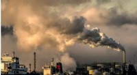
* Pollution: Monitoring air and water pollution, and tracking the spread of invasive species.
Other Applications:
* Mapping geological formations: Identifying rock types and geological structures.
* Archaeological sites: Identifying ancient settlements and cultural landscapes.
* Disaster response: Providing critical information to aid in disaster relief efforts.
Landsat's multispectral imagery allows scientists to identify different features based on their spectral signatures. This data is then used to create accurate maps that can be used for a variety of applications, including research, resource management, and environmental monitoring.