1. Mapping and Navigation:
* Precise location information: Geodesy provides the foundation for accurate maps and navigation systems. By determining precise coordinates on Earth's surface, it enables us to navigate effectively, whether by car, ship, or airplane.
* Infrastructure development: Geodesy is essential for the planning and construction of infrastructure projects, such as roads, bridges, pipelines, and buildings. Precise measurements ensure proper alignment, stability, and safety.
2. Environmental Monitoring and Disaster Management:
* Sea level rise and climate change: Geodesy helps monitor changes in Earth's surface, including sea level rise, which is a critical indicator of climate change.
* Earthquakes and volcanic activity: Precise measurements of ground deformation can provide early warning of earthquakes and volcanic eruptions, saving lives and mitigating damage.
* Land subsidence and sinkholes: Geodesy plays a crucial role in detecting and monitoring land subsidence and sinkholes, allowing for timely action to prevent damage to infrastructure and property.
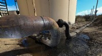
3. Resource Management and Exploitation:
* Mining and oil exploration: Geodetic techniques are used to map and monitor underground resources, facilitating efficient exploration and extraction.
* Agriculture and water management: Geodesy provides data for optimizing agricultural practices, managing water resources, and monitoring land use changes.
4. Space Exploration and Earth Observation:
* Satellite positioning and navigation: Geodesy underpins the development and operation of global positioning systems (GPS) and other satellite navigation technologies.
* Earth observation and remote sensing: Geodesy provides a framework for interpreting satellite data and understanding Earth's surface processes, including climate change and natural disasters.
5. Scientific Research and Understanding:
* Plate tectonics and Earth dynamics: Geodetic measurements contribute to our understanding of Earth's structure, plate tectonics, and other dynamic processes.
* Global reference systems: Geodesy provides a common framework for establishing and maintaining global reference systems, ensuring consistency and interoperability across different geographic regions.
In summary, geodesy is vital for our understanding of Earth, its environment, and its resources. It provides the foundation for accurate mapping, navigation, environmental monitoring, resource management, and scientific research, contributing significantly to our well-being and technological advancements.