* Flattening a sphere: The Earth is a sphere, but maps are flat. To represent the Earth on a flat surface, we need to distort it in some way. This distortion can affect distances, shapes, and areas.
* Types of distortions: Different map projections (methods of flattening the Earth) create different types of distortions. Some emphasize accurate distances, while others emphasize accurate shapes.
* Scale: Maps are always drawn at a scale (e.g., 1:100,000), meaning that one unit on the map represents a certain number of units in the real world. This scale determines how much detail the map can show.
* Simplification: Maps simplify reality to highlight important information. They often omit details like mountains, rivers, or buildings that aren't relevant to the map's purpose.
So, how is a map a model of the Earth?
* Representation: Maps provide a visual representation of the Earth's surface.
* Spatial information: They show the location of features (countries, cities, roads) and their relative positions to each other.
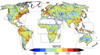
* Data visualization: Maps can be used to visualize various data, like population density, rainfall patterns, or economic activity.
It's important to remember that no single map can perfectly represent the Earth. Choosing the right map projection and understanding its limitations is crucial for interpreting information accurately.