1. Direct Observation:
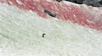
* Changes in landforms: This could include the presence of canyons, valleys, cliffs, or even smaller features like gullies and rills.
* Sediment deposition: Observing sediment deposits at the base of slopes, in riverbeds, or at the mouths of rivers is strong evidence for erosion.
* Exposed bedrock: The uncovering of bedrock due to the removal of soil and rock layers indicates erosion has occurred.
2. Indirect Evidence:
* Analysis of sediment: Examining the composition, size, and shape of sediment can tell us about the processes that eroded it (wind, water, ice) and the source of the material.
* Fossil evidence: Finding fossils in unusual locations, like on mountaintops or in unexpected rock layers, can indicate erosion and uplift.
* Geomorphic markers: Features like terraces, alluvial fans, and glacial moraines are direct indicators of past erosion.
3. Historical Data:
* Maps and aerial photographs: Comparing maps and aerial photographs from different times can show changes in landforms, indicating erosion.
* Historical accounts: Records and stories from people who lived in an area can provide information about erosion that has happened over time.
Overall, the most convincing evidence for erosion comes from a combination of these different factors, providing a comprehensive understanding of the erosive processes at work.
Here's a simple example:
* Imagine a hill with a steep slope.
* You observe a stream at the bottom of the hill, carrying sediment.
* This sediment is similar to the rock type found on the hill.
* This combination of observations strongly suggests that the hill is eroding, and the stream is carrying away the eroded material.
This is just one example; there are many ways to gather evidence for erosion.