Active Methods:
* Multibeam Sonar: This is the most common method for high-resolution seafloor mapping. It emits sound waves in a fan shape, measuring the time it takes for the sound to return. This data can be used to create detailed maps of the seafloor, including its depth, shape, and texture.
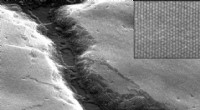
* Side-scan Sonar: This technique uses sound waves to create images of the seafloor, similar to an underwater photograph. It is particularly good for identifying objects on the seafloor, such as shipwrecks or geological features.
* Submersibles and ROVs: These underwater vehicles can be equipped with various sensors, including cameras and sonar, to collect detailed data on the seafloor. They can be used to explore areas that are too shallow or too deep for other methods.
* Satellite Altimetry: Satellites measure the height of the sea surface, which is affected by the gravity of the seafloor beneath. This data can be used to create maps of large-scale seafloor features.
Passive Methods:
* Gravity Measurements: Variations in the Earth's gravity field can reveal changes in the density of the seafloor, allowing for the mapping of large-scale geological features.
* Magnetometry: The magnetic field of the Earth can be used to detect magnetic anomalies on the seafloor, which can be used to map geological structures.
Other Techniques:
* GPS: While not directly used to map the seafloor, GPS is used for positioning ships and underwater vehicles to ensure the accuracy of mapping data.
* Bathymetry: This refers to the measurement of water depth. It is often used in conjunction with other mapping methods to create detailed maps of the seafloor.
Choosing the Right Technique:
The best method for seafloor mapping depends on the scale of the area being mapped, the desired level of detail, and the budget.
For example:
* Multibeam Sonar: Great for detailed mapping of smaller areas, but can be expensive for large-scale projects.
* Satellite Altimetry: Suitable for mapping large areas but less detailed than other methods.
* Submersibles and ROVs: Best for specific areas requiring high-resolution data, but are more expensive and time-consuming.
The combination of these techniques, along with the use of advanced data processing techniques, allows for the creation of comprehensive and accurate maps of the seafloor.