Mountains:
* Rocky Mountains: Stretching from Canada to New Mexico, these are the largest mountain range in North America.
* Appalachian Mountains: Running from Georgia to Maine, these are older and lower than the Rockies, known for their forested slopes and scenic beauty.
* Sierra Nevada: Located in California, these mountains are home to iconic peaks like Yosemite Valley and Mount Whitney, the highest point in the contiguous United States.
* Cascade Range: Extending from California to British Columbia, this range features volcanic peaks like Mount Rainier and Mount Shasta.
* Alaska Range: Home to Denali (formerly Mount McKinley), the tallest mountain in North America, this range is known for its rugged terrain and glaciers.
Plateaus:
* Colorado Plateau: Located in the southwestern United States, this high-elevation plateau is known for its canyons, mesas, and deserts.
* Columbia Plateau: Spanning parts of Washington, Oregon, and Idaho, this plateau is characterized by basalt plateaus and rolling hills.
Plains:
* Great Plains: A vast, flat expanse stretching from the Mississippi River to the Rocky Mountains, known for its grasslands and agriculture.
* Coastal Plains: Found along the Atlantic and Gulf coasts, these low-lying plains are often fertile and suitable for farming.
Deserts:
* Mojave Desert: Located in California, Nevada, Arizona, and Utah, this desert is known for its extreme temperatures and Joshua Tree National Park.
* Sonoran Desert: Spanning parts of Arizona, California, and Mexico, this desert is known for its cacti, saguaro, and diverse wildlife.
* Chihuahuan Desert: Extending from Texas into Mexico, this desert is the largest in North America and features a unique ecosystem.
Rivers:
* Mississippi River: The longest river in North America, flowing from Minnesota to the Gulf of Mexico.
* Missouri River: The longest tributary of the Mississippi, it flows through Montana, North Dakota, South Dakota, Nebraska, Iowa, Kansas, and Missouri.
* Rio Grande: The border between the United States and Mexico, it flows through Texas, New Mexico, and Colorado.
* Colorado River: Flows through the southwestern United States, carving out the Grand Canyon.
Lakes:
* Great Lakes: Five massive freshwater lakes (Superior, Michigan, Huron, Erie, Ontario) located on the border between the United States and Canada.
* Lake Champlain: Located on the border between Vermont and New York, known for its scenic beauty.
* Crater Lake: Located in Oregon, this lake fills a volcanic caldera, known for its deep blue waters.
Coastal Features:
* Pacific Coast: The western coast of the continent, characterized by dramatic cliffs, rugged mountains, and sandy beaches.
* Atlantic Coast: The eastern coast of the continent, featuring a variety of coastal landscapes, from sandy beaches to rocky cliffs.
* Gulf Coast: The southern coast of the continent, known for its marshes, estuaries, and beaches.
Other:
* Glaciers: Found in Alaska, the Rocky Mountains, and the Sierra Nevada, these glaciers are remnants of the last ice age.
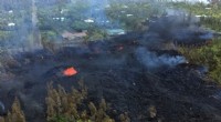
* Volcanoes: Found in the Cascade Range, the Aleutian Islands, and other regions, these volcanoes are reminders of the continent's geological activity.
Note: This is just a brief overview. Each of these features has a unique history, geography, and ecosystem.
For more detailed information, you can search for specific features on the internet or consult a geography textbook.