Direct Observation:
* Look for changes in rock formations: Look for rounded rocks, smooth surfaces, or cracks and crevices in rocks. These are all signs of weathering.
* Observe sediment transport: Watch how wind, water, or ice moves sand, soil, and rocks. This is erosion in action.
* Examine riverbeds and coastlines: Notice the changes in shape and features like sandbars, riverbanks, or cliffs. These are all signs of erosion by water.
* Study glacial valleys and moraines: These features are formed by the erosive power of glaciers.
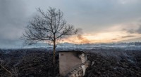
* Look for signs of soil erosion: Observe gullies, ditches, and exposed roots in fields, slopes, or near construction sites.
Indirect Observation:
* Analyze aerial photographs and satellite images: Compare images taken over time to see changes in landforms, coastlines, and vegetation due to erosion.
* Study geological maps and records: These documents can show the history of erosion and weathering in a particular area.
* Examine historical photographs and documents: Compare old and new photos of the same location to see how the landscape has changed.
* Measure and monitor soil erosion: Use specialized instruments to measure soil loss and track the rate of erosion.
Experimentation:
* Create weathering experiments: You can recreate weathering processes like freeze-thaw cycles or chemical weathering in a controlled environment.
* Simulate erosion: Build small-scale models of landscapes and experiment with wind or water erosion.
Remember: Observing erosion and weathering is not just about seeing dramatic changes in a short time. It's about understanding the slow, continuous processes that shape our planet over millions of years.