1. Navigation:
* Seafaring: Historically, latitude and longitude were crucial for mariners to navigate the vast oceans. Sailors used stars and celestial observations to determine their position, allowing them to plot courses and reach distant destinations.
* Air Travel: Modern aircraft navigation relies heavily on latitude and longitude. Pilots use these coordinates to chart flight paths, maintain safe distances from other aircraft, and land at their destination.
* GPS: The Global Positioning System (GPS) uses latitude and longitude to pinpoint your precise location anywhere on Earth. This technology is essential for everything from mapping and navigation apps to ride-sharing services and emergency response.
2. Mapping and Geographic Information:
* Creating Maps: Latitude and longitude are the foundation of all maps. They provide a consistent framework for organizing and representing geographic features like mountains, rivers, cities, and countries.
* Geographic Information Systems (GIS): GIS uses latitude and longitude to store, analyze, and visualize spatial data. This information is used for land management, urban planning, environmental monitoring, and disaster response.
3. Scientific Research:
* Understanding Climate: Latitude plays a significant role in determining climate patterns. Locations near the equator experience warmer temperatures and higher humidity due to the direct sunlight, while locations at higher latitudes experience colder temperatures and more seasonal variation.
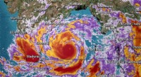
* Studying Natural Phenomena: Longitude and latitude are essential for tracking and analyzing weather patterns, earthquake epicenters, volcanic activity, and other natural phenomena.
* Mapping Biodiversity: Scientists use latitude and longitude to map the distribution of species and study patterns of biodiversity across the globe.
4. Communication and Collaboration:
* Standardized System: Latitude and longitude provide a common language for communicating locations across the globe. Anyone, regardless of their location or language, can understand a set of coordinates.
* Global Collaboration: This common system allows scientists, researchers, and professionals to share and analyze data, collaborate on projects, and work together to solve global challenges.
In summary, latitude and longitude are fundamental tools that allow us to understand, navigate, and interact with our planet. They are essential for everything from everyday navigation to scientific research and global cooperation.