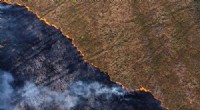
* National security: GEOINT can be used to track the movement of troops, identify potential threats, and assess the damage caused by natural disasters.
* Public safety: GEOINT can be used to map crime hotspots, identify evacuation routes, and locate missing persons.
* Business intelligence: GEOINT can be used to identify potential customers, track competitors, and optimize supply chain management.
* Environmental management: GEOINT can be used to monitor deforestation, track pollution, and manage water resources.
GEOINT is a relatively new field, but it is rapidly evolving. As technology continues to improve, GEOINT will become even more powerful and versatile.
GEOINT is based on the principle of georeferencing, which is the process of assigning a location to a piece of data. This can be done using a variety of methods, including:
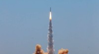
* GPS: GPS (Global Positioning System) is a satellite-based navigation system that can be used to track the location of an object with a high degree of accuracy.
* Remote sensing: Remote sensing is the process of collecting data about the Earth's surface from satellites or aircraft. This data can be used to create maps, identify land use patterns, and track environmental changes.
* GIS (Geographic Information Systems): GIS is a software platform that allows users to create, manage, and analyze spatial data. GIS can be used to combine data from different sources, create maps, and perform spatial analysis.
GEOINT offers a number of benefits over traditional forms of intelligence, including:
* Accuracy: GEOINT data is highly accurate, thanks to the use of advanced technology such as GPS and remote sensing.
* Timeliness: GEOINT data can be collected and disseminated quickly, which is essential for time-sensitive operations.
* Comprehensiveness: GEOINT data can provide a comprehensive view of an area, including information on physical features, human activity, and environmental conditions.
* Accessibility: GEOINT data is often available to a wide range of users, including government agencies, businesses, and the general public.
There are also a number of challenges associated with GEOINT, including:
* Data overload: The amount of GEOINT data available can be overwhelming, making it difficult to find the relevant information.
* Data security: GEOINT data can be sensitive, so it is important to ensure that it is properly protected.
* Data privacy: GEOINT data can be used to track the movement of individuals, which raises privacy concerns.
The future of GEOINT is bright. As technology continues to improve, GEOINT will become even more powerful and versatile. This will allow GEOINT to be used for a wider range of applications, including:
* Smart cities: GEOINT can be used to create smart cities that are more efficient, sustainable, and resilient.
* Autonomous vehicles: GEOINT can be used to help autonomous vehicles navigate safely and efficiently.
* Precision agriculture: GEOINT can be used to improve crop yields and reduce the use of pesticides and fertilizers.
* Disaster management: GEOINT can be used to predict, prepare for, and respond to natural disasters.
GEOINT is a powerful tool that has the potential to make the world a better place. As the field continues to evolve, we can expect to see even more innovative and groundbreaking applications of GEOINT in the years to come.