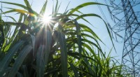
In the ever-evolving world of agriculture, technology has emerged as a game-changer, empowering farmers with innovative tools and methods to enhance crop production. One area where this collaboration shines is in the field of crop testing, which plays a crucial role in ensuring the quality and resilience of agricultural produce.
Addressing Challenges in Crop Testing
Traditional crop testing methods often rely on manual observations and sampling, which can be time-consuming, subjective, and prone to human error. Moreover, the need to test multiple varieties in various environmental conditions further complicates the process and increases the workload for farmers.
The Fusion of Tech and Expertise
Recognizing these challenges, tech-savvy innovators have joined forces with experienced farmers to develop cutting-edge solutions for crop testing. These solutions harness the power of sensors, drones, satellite imagery, and data analytics to provide farmers with precise, real-time insights into the performance and health of their crops.
Sensor Technology for Precision Testing
Innovative sensors placed within fields collect crucial data, including soil moisture, nutrient levels, pest infestation, and plant growth parameters. This information is then transmitted wirelessly to central hubs or mobile devices, allowing farmers to monitor crop conditions remotely and make informed decisions.
Drones for Visual Inspection and Pest Control
Drones equipped with high-resolution cameras fly over fields, capturing detailed images that help farmers identify nutrient deficiencies, disease outbreaks, and pest infestations at an early stage. These same drones can be used to apply pesticides or fertilizers with pinpoint accuracy, reducing chemical waste and the risk of environmental damage.
Satellite Imagery for Large-Scale Monitoring
Satellite images offer a bird's-eye view of entire farms and surrounding landscapes. Farmers can use this data to assess crop growth patterns, soil variability, irrigation requirements, and potential yield estimates, facilitating more accurate planning and resource management.
Data Analytics for Informed Decisions
The wealth of data collected from sensors, drones, and satellite imagery is processed using sophisticated data analytics tools. These tools generate reports, charts, and visualizations that enable farmers to identify trends, patterns, and potential risks, aiding in decision-making for optimal crop production.
Case Study: Improving Rice Yield in Southeast Asia
In Southeast Asia, where rice is a staple crop, the integration of technology in crop testing has led to tangible benefits. Farmers can now monitor water and nutrient levels in rice paddies, optimizing irrigation and maximizing harvests. In addition, drones equipped with thermal sensors have assisted in detecting pests and diseases, enabling farmers to take timely action and reduce crop damage.
Conclusion: Enhancing Farming through Collaboration
The collaborative efforts between farmers and technology pioneers have revolutionized crop testing, empowering farmers to make informed decisions based on real-time data. This fusion of expertise and innovation not only optimizes crop production but also ensures sustainability and reduces the environmental impact of farming practices. As the agricultural sector embraces technological advancements, the future of farming looks promising, with farmers at the forefront of innovation and success.