1. Tracking Hurricane Movement and Intensity:
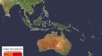
* Geostationary Satellites: These satellites orbit Earth at the same speed as the planet's rotation, providing continuous coverage of a specific region. They capture images of hurricanes every few minutes, allowing meteorologists to track their movement, size, and intensity.
* Polar-Orbiting Satellites: These satellites orbit Earth from pole to pole, passing over the same location every few days. They provide detailed measurements of atmospheric temperature, moisture, and wind speed, which are crucial for understanding hurricane development.
2. Measuring Hurricane Characteristics:
* Infrared Imagery: Satellites use infrared sensors to detect heat radiating from the Earth's surface. This allows them to visualize the cloud tops of a hurricane, which are very cold. The colder the cloud tops, the stronger the storm.
* Microwave Imagery: Microwaves can penetrate clouds, providing data even in heavy rain. This helps scientists monitor the hurricane's structure, including the eye, rainbands, and wind speed.
3. Predicting Hurricane Path and Intensity:
* Data Assimilation: Data collected by satellites, along with data from weather balloons, radar, and surface observations, are fed into complex computer models to predict the hurricane's future track and intensity.
4. Providing Real-time Information:
* Satellite images and data are crucial for issuing timely warnings to coastal communities and helping with evacuation efforts.
* They also assist in guiding emergency responders during and after a hurricane.
5. Research and Understanding:
* Satellites provide valuable data for scientists studying hurricane formation, evolution, and the impact of climate change on these storms.
Examples of Key Satellites for Hurricane Monitoring:
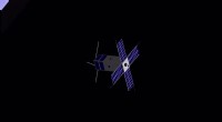
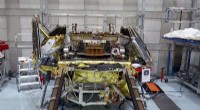
* GOES-R Series (Geostationary Operational Environmental Satellite-R Series): These US satellites provide high-resolution imagery and atmospheric data for hurricane tracking and forecasting.
* NOAA's POES (Polar-orbiting Operational Environmental Satellite System): These provide global coverage and detailed atmospheric measurements.
* NASA's Aqua and Terra Satellites: These carry a variety of instruments for monitoring the Earth's atmosphere, oceans, and land, including those crucial for hurricane research.
In conclusion, satellites are indispensable tools for understanding, monitoring, and forecasting hurricanes, ultimately helping to save lives and reduce the impact of these powerful storms.