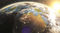
1. Global Coverage: Satellites can orbit the Earth, providing a comprehensive view of the entire planet. This allows for:
* Mapping and monitoring: Tracking changes in land use, deforestation, urban sprawl, and natural disasters.
* Global climate monitoring: Observing temperature, sea level rise, and ice melt.
* Resource management: Monitoring agricultural yields, water resources, and mineral deposits.
2. High Spatial Resolution: Some satellites are equipped with powerful cameras and sensors that can capture detailed images of Earth's surface. This allows for:
* Precise measurements: Studying landforms, vegetation patterns, and urban development with high accuracy.
* Disaster response: Assessing damage caused by earthquakes, floods, and other natural disasters.
* Environmental monitoring: Identifying pollution sources, tracking wildlife populations, and monitoring environmental changes.
3. Multispectral and Hyperspectral Imaging: Satellites can capture images in different wavelengths of light, providing information beyond what the human eye can see. This allows for:
* Analyzing composition: Identifying different minerals, vegetation types, and soil types.
* Detecting hidden features: Mapping underground water sources, identifying archaeological sites, and detecting pollution.
* Monitoring plant health: Assessing crop stress, detecting disease outbreaks, and optimizing agricultural practices.
4. Long-Term Monitoring: Satellites can observe the Earth's surface over time, providing valuable data for:
* Climate change studies: Tracking long-term trends in temperature, sea level rise, and ice melt.
* Land degradation analysis: Assessing the impact of human activities on the environment.
* Predicting future events: Identifying areas at risk of drought, floods, or other natural disasters.
5. Data Accessibility: Satellite data is often freely available to researchers and the public, facilitating collaboration and knowledge sharing. This allows for:
* Public awareness: Educating the public about environmental issues and promoting sustainable practices.
* Citizen science: Engaging the public in data analysis and research.
* Policy decisions: Informing policymakers on environmental issues and resource management.
In conclusion, satellites provide an invaluable tool for scientists to understand and monitor our planet. They offer global coverage, high-resolution images, multispectral capabilities, long-term data, and open accessibility, enabling scientists to address crucial challenges in various fields, from climate change to disaster response and resource management.