Here's why:
* Altitude: High altitude clouds form above 6,000 meters (20,000 feet). At these heights, temperatures are well below freezing.
* Water Vapor: While the air is very dry at high altitudes, there's still some water vapor present.
* Freezing: When this water vapor encounters the extremely cold temperatures, it freezes into tiny ice crystals.
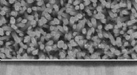
Types of High Altitude Clouds:
There are several types of high altitude clouds, including:
* Cirrus: Delicate, wispy clouds that look like feathers.
* Cirrocumulus: Small, puffy clouds arranged in rows or patches.
* Cirrostratus: Thin, sheet-like clouds that can cover the entire sky.
* Cirrostratus fibratus: This type of cirrostratus cloud, also known as "mare's tails," is a good indicator of an approaching warm front.
It's important to note that some cirrus clouds can contain a mix of ice crystals and supercooled water droplets. This is because the freezing point of water can be depressed in the presence of certain impurities.