Physical Characteristics:
* Reflectance: How much light is reflected from the surface, indicating different materials like vegetation, water, soil, or concrete. This can be used to map land cover and vegetation health.
* Temperature: Surface temperature, useful for monitoring heat islands, forest fires, and volcanic activity.
* Elevation: The height of the terrain, essential for creating digital elevation models and understanding topography.
* Atmospheric properties: Composition, temperature, humidity, and other atmospheric characteristics can be measured to study weather patterns, climate change, and pollution.
* Oceanographic properties: Sea surface temperature, salinity, chlorophyll concentration, and currents can be measured to study marine life, ocean circulation, and climate.
Human-Made Features:
* Urban development: Monitoring urban sprawl, building construction, and infrastructure changes.
* Infrastructure: Mapping roads, bridges, pipelines, and other infrastructure for disaster response, planning, and maintenance.
* Agriculture: Assessing crop health, irrigation needs, and agricultural yields.
Beyond the Basics:
* Radar data: Provides information on surface roughness, vegetation structure, and precipitation.
* Gravity data: Used to study the Earth's interior and tectonic plate movements.
* Magnetometry: Measures magnetic field variations, useful for mineral exploration and geological studies.
Applications:
These measurements are crucial for many applications, including:
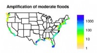
* Environmental monitoring: Tracking deforestation, pollution, climate change, and natural disasters.
* Resource management: Assessing water resources, forest resources, and agricultural land.
* Disaster response: Mapping damage from earthquakes, floods, and wildfires.
* Urban planning: Analyzing urban growth, infrastructure needs, and transportation planning.
* Military and intelligence: Surveillance, reconnaissance, and target identification.
The type of information gathered and the specific applications depend on the type of satellite and its sensors. Some satellites are designed for specific purposes, while others are multi-purpose, capable of collecting various types of data.