1. Field Research and Data Collection:
* Precise Location Tracking: GPS allows scientists to pinpoint the exact location of their research sites, ensuring accurate data collection and analysis. This is crucial for studying geological formations, mapping ecosystems, tracking animal movements, and monitoring environmental changes.
* Data Correlation: GPS coordinates enable scientists to correlate collected data with specific locations, allowing for detailed analysis of spatial patterns and relationships.
* Sampling and Monitoring: GPS helps scientists efficiently navigate to specific sampling points and monitor changes over time in various environmental parameters like air quality, water levels, or soil composition.
2. Geospatial Analysis and Modeling:
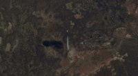
* Mapping and Visualization: GPS data is fundamental for creating detailed maps and visualizations of the Earth's surface, including geological features, vegetation patterns, and population distribution.
* Spatial Statistics and Modeling: GPS enables scientists to perform spatial statistical analyses and build models that predict and understand the distribution of phenomena across geographic landscapes.
* Environmental Impact Assessment: GPS helps assess the impact of human activities on the environment by mapping and analyzing changes in land use, pollution levels, and natural resource distribution.
3. Disaster Monitoring and Response:
* Real-Time Tracking: GPS is used to track the movement of natural disasters like hurricanes, earthquakes, and volcanic eruptions, providing valuable information for disaster preparedness and response.
* Rescue Operations: GPS allows for rapid location and rescue efforts during emergency situations, saving lives and minimizing damage.
* Disaster Assessment: Post-disaster, GPS is crucial for mapping the extent of damage and assessing the impact on infrastructure and the environment.
4. Climate Change Research:
* Monitoring Glaciers and Sea Ice: GPS helps track changes in the size and movement of glaciers and sea ice, providing critical data for understanding climate change impacts.
* Sea Level Rise Assessment: GPS data assists in measuring sea level rise and understanding its impact on coastal regions.
* Climate Modeling: GPS-derived data is used to validate and improve climate models that predict future environmental changes.
5. Resource Management:
* Resource Exploration: GPS assists in locating and mapping potential mineral and energy resources.
* Sustainable Land Use: GPS helps manage natural resources by optimizing land use practices and monitoring environmental impacts.
* Forest Management: GPS enables efficient forest management by tracking forest boundaries, monitoring deforestation, and optimizing logging operations.
Overall, GPS navigation is an indispensable tool for Earth scientists, empowering them to conduct field research, analyze geospatial data, monitor environmental changes, respond to disasters, and manage resources effectively. It is a cornerstone of modern Earth science research and a key factor in understanding and addressing the planet's complex challenges.