Surface Observations:
* Automated Surface Observing Systems (ASOS): These are automated stations found at airports and other locations. They measure temperature, humidity, wind speed and direction, precipitation, visibility, and cloud cover.
* Cooperative Observer Network (COOP): This is a volunteer network of individuals who take manual weather observations at their homes or businesses. They measure temperature, precipitation, and other variables.
* Weather Balloons (Radiosondes): These instruments are released twice daily from hundreds of locations around the world. They rise through the atmosphere, measuring temperature, humidity, wind speed and direction, and atmospheric pressure. The data is transmitted back to the ground via radio.
* Surface Weather Stations: These are manual stations that are often used by airports, universities, and other institutions. They measure the same variables as ASOS stations, but they require a human observer.
Upper Air Observations:
* Doppler Radar: This technology uses radio waves to detect precipitation, wind speed and direction, and other weather phenomena. It can provide detailed information about the structure and movement of storms.
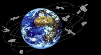
* Satellite Imagery: Satellites orbiting the Earth collect data on cloud cover, temperature, humidity, and other variables. This data is used to create images and maps that can be used to track weather systems.
* Aircraft Observations: Commercial and military aircraft are equipped with instruments that measure weather conditions. This data is used to improve weather forecasts and provide information to pilots.
* Lightning Detection Networks: These networks use sensors to detect lightning strikes and provide information on their location, intensity, and frequency.
Other Data Sources:
* Ocean Buoys: Buoys are deployed in oceans and lakes to measure temperature, salinity, wave height, and other oceanographic variables. This data is used to understand weather patterns and climate change.
* Weather Models: Meteorologists use computer models to simulate the atmosphere and predict future weather conditions. These models are fed data from various sources, including surface observations, upper air observations, and satellite imagery.
All this data is collected, analyzed, and interpreted by meteorologists to create weather forecasts, warn of severe weather events, and understand climate change.