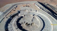
1. Land Use and Planning: Satellite images provide detailed information about land cover, land use, and changes over time. This information aids in urban planning, zoning regulations, and ensuring the sustainable use of land resources.
2. Agriculture: Satellite imagery helps monitor crop health, identify areas of stress or disease, and estimate crop yields. This information assists farmers in making informed decisions about irrigation, fertilization, and harvesting, leading to increased agricultural productivity.
3. Forestry: Satellite imagery is utilized to monitor forest cover, detect deforestation, and identify areas of forest fires or insect infestations. This information supports sustainable forest management practices and conservation efforts.
4. Natural Disaster Management: Satellite imagery is crucial in disaster management. It provides real-time information about floods, earthquakes, wildfires, volcanic eruptions, and other natural disasters. This information aids in emergency response, relief efforts, and recovery planning.
5. Environmental Monitoring: Satellite imagery is used to monitor environmental changes such as sea level rise, glacier retreat, desertification, and changes in vegetation cover. This information supports climate change research, environmental impact assessments, and conservation initiatives.
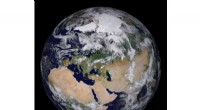
6. Weather Forecasting: Satellite imagery is essential for weather forecasting. Satellites collect data on cloud formations, precipitation, temperature, and wind patterns, contributing to accurate weather predictions and early warning systems for extreme weather events.
7. Transportation and Infrastructure Planning: Satellite imagery assists in planning and managing transportation networks, including roads, railways, and airports. It helps identify the most suitable routes, assess traffic patterns, and plan infrastructure development.
8. Urban Planning and Management: Satellite imagery supports urban planning, including zoning regulations, land use allocation, and infrastructure development. It aids in managing urban growth, enhancing urban services, and ensuring the well-being of citizens.
9. Disaster Risk Assessment: Satellite imagery aids in assessing vulnerability and risk levels for various hazards. This information is crucial for disaster preparedness, risk reduction, and community resilience planning.
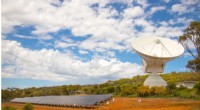
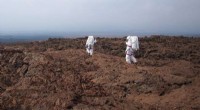
10. Exploration and Discovery: Satellite imagery has contributed to scientific research and exploration, such as mapping remote regions, studying planetary surfaces, and even discovering new celestial objects.
Overall, satellite imagery provides valuable information for decision-making, monitoring, and managing resources across various sectors, making it an essential tool for sustainable development and the advancement of human society.