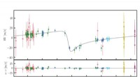
According to NASA's Earth Observatory, “The 2009 ozone hole reached a maximum area of about 10 million square miles (25.6 million square kilometers) on September 24. That's about the same size as North America. The hole opened in late August, and it continued to grow until late September. Since then, it has been shrinking. By December 1, the ozone hole had lost 65 percent of the area it covered at its peak.”
Ozone loss in the Antarctic happens during late winter and early spring (August-November) as the sun's rays begin striking the edge of the icy continent after months of darkness. Special stratospheric weather conditions that persist in the cold months over the pole isolate Antarctica's atmosphere and prevent ozone from being replenished by ozone transport.
These particular weather conditions are what scientists call a polar vortex. As NASA explains: “A polar vortex is a large-scale circulation that persists for weeks or months in the winter polar stratosphere. In the Southern Hemisphere, the vortex is strongest during September and October. The stratospheric air inside the vortex is extremely cold, and the low temperatures are what lead to the ozone destruction. If the vortex breaks down or weakens, warmer air can mix into the stratosphere, stopping ozone destruction.”
Since the middle of August, the 2009 ozone hole has been observed with near-identical levels of area coverage throughout the peak months. In previous years (like 2006), the ozone hole grew rapidly before peaking and quickly reduced in area coverage. NASA says this year's steady pattern is due to the strength of the unusually cold and stable Southern Hemispheric polar vortex.
“For the past forty-five years, NASA has been at the forefront of studying atmospheric ozone, its variability and change,” said Dr. James Butler of NASA's Goddard Space Flight Center. “The first hint that human activities were damaging the stratospheric ozone layer came from NASA data collected in the late 1970's. Today, NASA satellite observations are routinely used by the scientific and management community to monitor the recovery of the ozone layer under the Montreal Protocol.”
The Montreal Protocol is an international agreement that went into effect in 1989. It calls for the elimination of production and consumption of ozone-depleting substances, such as chlorofluorocarbons (CFCs) that were once used in refrigerators and aerosol spray cans.
For more information on NASA's ozone monitoring capabilities and data, please visit the following links:
- [NASA Ozone Watch](http://ozonewatch.gsfc.nasa.gov/)
- [Aura Mission Web Site](http://aura.gsfc.nasa.gov/)
- [Aura MLS (Microwave Limb Sounder) Web Page](http://mls.jpl.nasa.gov/index.php)
- [Aura OMI (Ozone Monitoring Instrument) Web Page](http://aura.gsfc.nasa.gov/instruments/omi.html)